Tafarai Bayne of TRUST SouthLA and John Jones of ESR launch the map at CicLAvia 2012 (Photo credit: Sahra Sulaiman)
We launched the RideSouthLA map during Sunday’s CicLAvia, at the South Hub in front of the African American Firefighter Museum. We handed out about 500 copies of the map, and many people asked “when is the next ride?”. No date has been set yet, but the East Side Riders tell us that they are planning to lead neighborhood tours in the coming months. We will post the Ride Schedule on this site. In the meantime, you can sign up to be notified of upcoming rides through South LA.
Here is a birds-eye view of the “south spur” at CicLAvia (our map distribution tent is in the center):

The folding of the maps seems critical — but is a bit expensive. We were thrilled to get this back from the printer:

Handing out maps was great fun — here are Cesar and Otto at work:

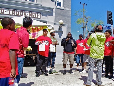
Handing out the map spurred conversation:

As George explained the map, our iPad on the table showed more pictures from the ride. We are continuing to investigate how the digital and print can interlock:

Partnership is the core of the effort. When we had to leave, the staff at TRUST South LA took over distribution from their table: